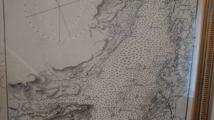
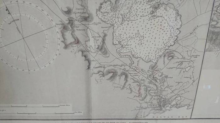
Lough Corrib and Mask Admiralty Chart

Asking price:
€230
Make an offer:
- Seller:
-
ClearedOut
Top Seller

- Feedback:
-
52 0
- Location:
- 16 more ads from this seller
- Entered/Renewed:
- 4 years ago
- Ad Views:
- 869


Viewing
1
of
15
Lough Corrib and Mask Admiralty Chart
Lough Corrib and Mask Admiralty Chart
Description
Condition:
New
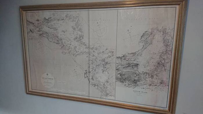
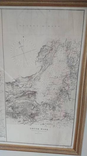
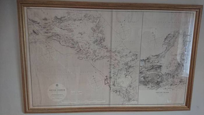
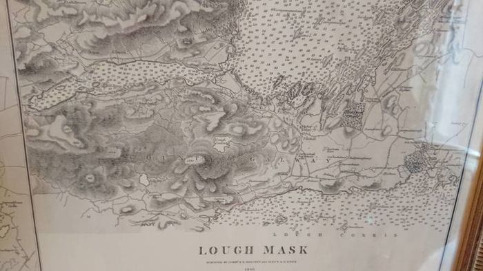
Beautifully framed Admiralty Chart of Lough Corrib and Mask. Originally surveyed by Commander R. B. Beechey and Lieutenant A. G. E. Dye in 1846.
Ideal for a sailing, fishing or boating enthusiast's wall, study, dining room.
Would also be at home in a similar restaurant or bar.
Soundings, islands, landmarks features all named and listed.
A fabulous piece to enhance any wall and room. Also for a talking point and reference guide.
It measures 112x70 cms
Thanks for looking
Shipping: Collection To be arranged
To be arranged
Payment: CashPaypalBank transferTo be arranged
PaypalBank transferTo be arranged
From sellers around the web:
Comments & Offers


Asking Price: €230  No swaps
Ask Question
Make Offer
See more in our Documents & Maps category available today

€80.00
€25.00

€80.00

€20.00

€8.00

€80.00

€80.00

€80.00

€20.00

€9.00

€5.00

€25.00
€80.00

€10.00

€50.00

€200.00

€8.00

€160.00

€80.00
€99.00